From the Wikipedia entry for Atlas Mountains:

The Atlas Mountains are a mountain range in the Maghreb. It stretches around 2,500 km (1,550 miles) through Morocco, Algeria and Tunisia. The range's highest peak is Toubkal, with an elevation of 4,167 m (13,671 ft) in southwestern Morocco. It separates the Mediterranean and Atlantic coastlines from the Sahara Desert. The Atlas mountains are primarily inhabited by Berber populations. The terms for 'mountain' in some Berber languages are adrar and adras, which are believed to be cognates of the toponym Atlas. The mountains are home to a number of animal and plants unique in Africa, often more like those of Europe; many of them are endangered and some have already gone extinct.

The three main regions in Morocco are from north to south the Middle Atlas, High Atlas, and Anti-Atlas.

All pictures are © Dr. Günther Eichhorn, unless otherwise noted.

Ifrane

From the Wikipedia entry for Ifrane:

Ifrane is a city in the Middle Atlas region of Morocco (population 73,782 in November 2014). The capital of Ifrane Province in the region of Fès-Meknès, Ifrane is located at an elevation of 1,665 m (5,463 ft). In Tamazight, the regional Berber language, "ifran" means caves.

The modern town of Ifrane was established by the French administration in 1928 during the protectorate era for their administration due to its Alpine climate. Ifrane was conceived as a “hill station” or colonial type of settlement. It is a resort town set high up in the mountains so that Europeans can find relief from the summer heat of tropical colonies. Ifrane is also a popular altitude training destination.

Ifrane is sometimes called the "Switzerland" of Africa, because of its Alpine climate.

Ifrane
Ifrane. (816k)
Lion Statue Park Ifrane
Lion statue in a park in Ifrane. (1312k)

Middle and High Atlas

Foothills Middle Atlas
Foothills of the Middle Atlas. (655k)
Settlement Middle Atlas
Settlement in the Middle Atlas. (847k)
Middle Atlas Landscape
Middle Atlas landscape. (798k)
River Middle Atlas
River in the Middle Atlas. (689k)
Plains Between Middle Atlas
Plains between the Middle Atlas and the High Atlas. (677k)
Village Zebzat Located Between
The village Zebzat, located between the Middle Atlas and the High Atlas. (602k)
Kasbah Ouarzazate South High
The Kasbah in Ouarzazate, south of the High Atlas. (782k)
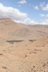
Rock Formation Between Middle
Rock formation between the Middle Atlas and the High Atlas. (634k)
High Atlas Distance
High Atlas in the distance. (745k)
Approaching High Atlas
Approaching the High Atlas. (704k)
Approaching High Atlas
Approaching the High Atlas. (587k)
Mountains High Atlas
Mountains in the High Atlas. (810k)
Mountains High Atlas
Mountains in the High Atlas. (813k)
Mountains High Atlas
Mountains in the High Atlas. (845k)
Mountains High Atlas
Mountains in the High Atlas. (912k)
Snow High Atlas
Snow on the High Atlas. (807k)
Switchback Road Over High
Switchback road over the High Atlas. (941k)

Todgha River Gorge

From the Wikipedia entry for Todgha Gorge:

The Todgha Gorges are a series of limestone river canyons, or wadi, in the eastern part of the High Atlas Mountains in Morocco, near the town of Tinghir. Both the Todgha and neighboring Dades Rivers are responsible for carving out these deep cliff-sided canyons, on their final 40 km (25 miles) through the mountains. The height of the canyon walls can vary, but in some places can be up to 400 m (1,310 ft) high.

City Tinghir South High
City of Tinghir, south of the High Atlas. (762k)
Village Aït Ismene Et
Village of Aït Ismene et Ihjjamen. (1074k)
Village Todgha River
Village on the Todgha river. (1265k)
Village Todgha River
Village on the Todgha river. (868k)

Dades River Gorge

Village Dades River Gorge
Village in the Dades River Gorge. (764k)
School Dades River Gorge
School in the Dades River Gorge. (621k)
Village Dades River Gorge
Village in the Dades River Gorge. (864k)
Abandoned Village Dades River
Abandoned village in the Dades River Gorge. (1121k)
Partially Abandoned Village Dades
Partially abandoned village in the Dades River Gorge. (910k)
Partially Abandoned Buildings Dades
Partially abandoned buildings in the Dades River Gorge. (637k)
Partially Abandoned Building Dades
Partially abandoned building in the Dades River Gorge. (730k)
Kasbah Dades River Gorge
Kasbah in the Dades River Gorge. (1037k)
Kasbah Dades River Gorge
Kasbah in the Dades River Gorge. (922k)
Cemetery Dades River Gorge
Cemetery in the Dades River Gorge. (1278k)
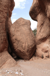
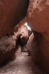
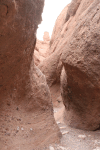
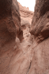
Entrance Valley Figs Very
Entrance to the Valley of the Figs, a very narrow slot canyon in the Dades River Valley. (990k)
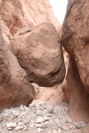
Valley Figs We Had
In the Valley of the Figs. We had to crawl under this hanging boulder. (901k)
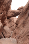
Valley Figs
In the Valley of the Figs. (973k)
Valley Figs
In the Valley of the Figs. (783k)
Valley Figs
In the Valley of the Figs. (1065k)
Valley Figs
In the Valley of the Figs. (923k)
Common Fig (Ficus carica)
Common Fig Tree (Ficus carica, german: Echte Feige, french: Figuier comestible) in the Valley of the Figs. (1172k)

Aït Ben Haddou

From the Wikipedia entry for Aït Ben Haddou:

Aït Ben Haddou is an ighrem (fortified village) (ksar in Arabic), along the former caravan route between the Sahara and Marrakesh. Most citizens attracted by the tourist trade live in more modern dwellings in a village on the other side of the river, although there are four families still living in the ancient village. Inside the walls of the ksar are half a dozen Kasbahs or merchants houses and other individual dwellings, and is a great example of Moroccan earthen clay architecture.

The Ksar of Aït-Ben Haddou is a UNESCO World Heritage Site.

Ksar Aït Ben Haddou
Ksar of Aït Ben Haddou. (933k)
Ksar Aït Ben Haddou
Ksar of Aït Ben Haddou in the foreground and modern Aït Ben Haddou beyond the river. (943k)
River Crossing Aït Ben
River crossing to Aït Ben Haddou. (1008k)
Building Top Aït Ben
Building on top of Aït Ben Haddou. (887k)
Buildings Ksar Aït Ben
Buildings in the Ksar of Aït Ben Haddou. (1098k)
Buildings Ksar Aït Ben
Buildings in the Ksar of Aït Ben Haddou. (1057k)
Inside Buildings Ksar Aït
Inside one of the buildings in the Ksar of Aït Ben Haddou. (714k)

This page contains 47 pictures with 1 species

Morocco
Main page for المغرب (Morocco)

Page last updated on Tue Nov 2 15:51:36 2021 (Mountain Standard Time)


Page last updated on Thu Apr 25 21:35:04 2024 (Mountain Standard Time)

Middle and High Atlas on aerobaticsweb.org


© Dr. Günther Eichhorn
Retired
Email Guenther Eichhorn

*Dr. Günther Eichhorn Travel Website
*Soaring website